Mōtung:Stǣr Sūðes Georgian and þāra Sūðra Sandwīc Īega
Hi! I wonder if someone might be interested in translating the article History of South Georgia and the South Sandwich Islands proposed below? Apcbg 01:30, 23 Þrimilcemōnaþ 2006 (UTC)
| |||
| Motto: Leo Terram Propriam Protegat (Latin: Let the lion protect its own land) National anthem: God Save the Queen | |||
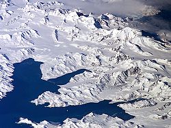
South Georgia is one of the most beautiful places in the world, described as the Himalayas of the Southern Ocean. It is a nature paradise, and a country of rich historical heritage.
Introduction
[adiht fruman]
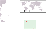
Together with the South Sandwich Islands, Shag Rocks and Clerke Rocks, South Georgia forms the UK overseas territory of South Georgia and the South Sandwich Islands. While that territory is slightly larger than the U.S. state of Rhode Island or the island of Mallorca, its 200-mile exclusive economic zone (EEZ) is twice the size of the EEZ of the United Kingdom, and covers 1.4 million sq. km of some of the biologically most productive waters in the world ocean.
Due to its remote location and harsh climate South Georgia has had no indigenous population, and no families have become established for more than one generation so far.
XVII-XIX Century
[adiht fruman]The South Atlantic island of South Georgia, situated south of the Antarctic Convergence, was the first Antarctic territory ever discovered. The London merchant Antony de la Roché, while sailing from Chile to Brazil, was carried far away to the east in bad weather. His ship anchored in one of the bays of the island for 14 days in April 1675. Cartographers started to depict ‘Roché Island’ on their maps, in honour of the discoverer. The second sighting happened in 1756, when the island was named ‘San Pedro’ by the passing Spanish vessel León. These early visits did not result in sovereignty claims. In particular, Spain never claimed South Georgia, which was supposed to become Portuguese according to the Treaty of Tordesillas signed by Spain and Portugal in 1494.

The great navigator Captain James Cook made the first landing, exploration and mapping of South Georgia. He renamed the island ‘Isle of Georgia’ for King George III, and took possession for Britain on 17 January 1775 as instructed by the British Admiralty. Captain Cook also discovered the South Sandwich Islands.

During the late eighteenth century and throughout the nineteenth century South Georgia was inhabited by British and American sealers, who lived there for considerable periods of time and sometimes overwintered. The effective, continuous and unchallenged British possession and government for South Georgia was provided for by the British Letters Patent of 1843, revised in 1876, 1892, 1908 and 1917. The island appeared in the Colonial Office Yearbook since 1887. Britain regulated the sealing industry and conservation by administrative acts in 1881 and 1899. South Georgia was governed as a Falkland Islands Dependency, a distinct entity administered through the Falkland Islands but not part of them in political or financial respect. The South Sandwich Islands were formally annexed by the British Letters Patent of 1908. These constitutional arrangements stayed in place until South Georgia and the South Sandwich Islands were incorporated as a distinct British overseas territory in 1985.
XX Century
[adiht fruman]
In the twentieth century South Georgia became the world largest whaling centre, with shore bases at Grytviken, Leith Harbour, Ocean Harbour, Husvik, Stromness and Prince Olav Harbour. All whaling stations on the island operated under whaling leases granted by the Governor of the Falkland Islands and Dependencies.
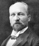
Carl Anton Larsen, the founder of Grytviken, was a naturalized Briton born in Norway. His application for British citizenship was submitted to the British Magistrate of South Georgia and granted in 1910. As the manager of Compañía Argentina de Pesca, Larsen organized the construction of Grytviken ― a remarkable undertaking accomplished by a team of 60 Norwegians since their arrival on 16 November until the newly built whale oil factory started production on 24 December 1904. Larsen chose the site for the whaling station during his visit in 1902, when the Swedish Antarctic Expedition surveyed part of the island and gave the name Grytviken (‘Pot Cove’) because of the discovered numerous artifacts including English pots used by the sealers to boil seal oil. Most of the whalers were Norwegian, with an increasing proportion of Britons. During the whaling era, the population usually varied from over 1000 in the summer (over 2000 in some years) to some 200 in the winter. The first census conducted by the British Stipendiary Magistrate James Wilson on 31 December 1909 recorded a total population of 720, including 3 females and 1 child. Of them, 579 were Norwegian, 58 Swedes, 32 Britons, 16 Danes, 15 Finns, 9 Germans, 7 Russians, 2 Dutchmen, 1 Frenchman and 1 Austrian.

Managers and other senior officers of the whaling stations often lived together with their families. Among them was Fridthjof Jacobsen and his wife Klara Olette Jacobsen whose daughter Solveig Gunbjörg Jacobsen was the first child ever born in Antarctica, on 8 October 1913. There are some 200 graves on the island dating from 1820 onwards, including that of the famous Antarctic explorer Sir Ernest Shackleton (d. 1922) who in 1916 crossed Scotia Sea in one of the most remarkable small boat journeys in maritime history, and reached South Georgia to organize the successful rescue of his expedition team stranded in the South Shetland Islands.
A Magistrate conducting the local British administration has been residing in South Georgia ever since November 1909. The 1908 British Letters Patent was transmitted to the Argentine Foreign Ministry and was formally acknowledged on 18 March 1909 without objections. The first official announcement of an Argentine claim of South Georgia was made as late as 1927, and the first Argentine pretension of sovereignty over the South Sandwich Islands was made even in 1938. Since then, Argentina has maintained her claims of South Georgia and the South Sandwich Islands but repeatedly (in 1947, 1951, 1953, 1954 and 1955) refused to have them resolved by the International Court of Justice or by an independent arbitral tribunal.

The Argentine naval station Corbeta Uruguay was clandestinely built on Thule Island, South Sandwich Islands on 7 November 1976. Britain protested in January 1977, and eventually removed the Argentine personnel in 1982. During the Falklands War, the Argentine forces occupied Grytviken and Leith Harbour on 3 April after a two-hour battle in which the Argentine frigate Guerrico was severely damaged and an Argentine helicopter was shot down. On 25 April 1982 the Royal Navy damaged and captured the Argentine submarine Santa Fé at South Georgia, and the Argentine garrison surrendered.
Since the Falklands War Britain maintained a small garrison of Royal Marines on South Georgia until March 2001. The present centres of population include Grytviken, King Edward Point (port of entry, and residence of the Bitish Magistrate and harbour, customs, immigration, fisheries, and postal authorities), Bird Island and Husvik. Since 1995 the South African Weather Bureau maintains two automatic weather stations on the islands of Zavodovski and Thule in the uninhabited South Sandwich group.
References
[adiht fruman]- Seventeenth Century Map featuring Roché Island
- Eighteenth Century Map featuring Roché Island
- Capt. Francisco de Seixas y Lovera, Descripcion geographica, y derrotero de la region austral Magallanica. Que se dirige al Rey nuestro señor, gran monarca de España, y sus dominios en Europa, Emperador del Nuevo Mundo Americano, y Rey de los reynos de la Filipinas y Malucas, Madrid, Antonio de Zafra, 1690. (Narrates the discovery of South Georgia by the Englishman Antony de la Roché in April 1675.)
- James Cook, Chart of the Discoveries made in the South Atlantic Ocean, in His Majestys Ship Resolution, under the Command of Captain Cook, in January 1775, W. Strahan and T. Cadel, London, 1777.
- George Forster, A Voyage Round the World in His Britannic Majesty's Sloop Resolution Commanded by Capt. James Cook, during the Years 1772, 3, 4 and 5 (2 vols.), London, 1777.
- Robert K. Headland, The Island of South Georgia, Cambridge University Press, 1984.

