
Ymele:Map of Alaska highlighting Anchorage Municipality.svg

Size of this PNG preview of this SVG file: 800 be 423 dotta. Oðra metinga brædo: 320 be 169 dotta | 640 be 338 dotta | 1,024 be 541 dotta | 1,280 be 677 dotta | 2,560 be 1,353 dotta | 1,470 be 777 dotta.
Frumlicu ymele (SVG ymele, rihte 1,470 × 777 pixela, ymelan micelness: 338 KB)
Scortness
| Towritenness |
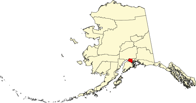
English: This is a locator map showing Anchorage Municipality in Alaska |
| Tælmearc | |
| Fruma |
Agen weorc: English: The maps use data from nationalatlas.gov, specifically countyp020.tar.gz on the Raw Data Download page. The maps also use state outline data from statesp020.tar.gz. The Florida maps use hydrogm020.tar.gz to display Lake Okeechobee. |
| Dædfruma | David Benbennick |
| SVG genesis |
Leaf:
| I, the copyright holder of this work, release this work into the public domain. This applies worldwide. In some countries this may not be legally possible; if so: I grant anyone the right to use this work for any purpose, without any conditions, unless such conditions are required by law. |
Ymelan stær
Swing dæg/tide mid mys to seonne þa ymelan swa heo wæs on þære tide geywed.
| Dæg/Tid | Metungincel | Micelnesse gemetu | Brucend | Ymbspræc | |
|---|---|---|---|---|---|
| nu | 19:25, 5 Hreðmonað 2006 | | 1,470 × 777 (338 KB) | David Benbennick | {{subst:User:Dbenbenn/clm|county=Anchorage Municipality|state=Alaska|type=borough and census area}} |
Biliþbendas
Þā folgendan trametas bindaþ tō þissum biliðe:
Ymelan eormen nytt
Þas wiki brucaþ þissa ymelena:
- Nytt on af.wikipedia.org
- Nytt on am.wikipedia.org
- Nytt on ar.wikipedia.org
- Nytt on arz.wikipedia.org
- Nytt on ast.wikipedia.org
- Nytt on bn.wikipedia.org
- Nytt on bpy.wikipedia.org
- Nytt on br.wikipedia.org
- Nytt on ca.wikipedia.org
- Nytt on ceb.wikipedia.org
- Nytt on cs.wikipedia.org
- Nytt on da.wikipedia.org
- Nytt on diq.wikipedia.org
- Nytt on el.wikipedia.org
- Nytt on en.wikipedia.org
- List of boroughs and census areas in Alaska
- Eklutna, Anchorage
- Mount Palmer (Alaska)
- Girdwood, Anchorage, Alaska
- Portage Glacier
- Flattop Mountain (Anchorage, Alaska)
- Alaska Botanical Garden
- Chugiak, Anchorage
- Eagle River, Anchorage, Alaska
- H2Oasis Indoor Waterpark
- Alaska Star
- Anchorage Press
- Goose Lake (Anchorage)
- Anchorage Symphony Orchestra
- Fort Richardson (Alaska)
- Wikipedia:WikiProject Alaska
- Alaska Native Heritage Center
- Oscar Anderson House Museum
- Wayland Baptist University (Alaska)
- Petroleum News
- Conoco-Phillips Building
- KNBA
- Ship Creek (Alaska)
- UAA/APU Consortium Library
- Anchorage Football Stadium
- Joint Task Force-Alaska
- Denaʼina Civic and Convention Center
- Egan Center
- Anchorage, Alaska
- Buckner Fieldhouse
- KBFX (FM)
- KWHL
- KBRJ
- KMXS
- KYMG
View more global usage of this file.