
Ymele:Indochina map 1886.jpg

Frumlicu ymele (1,626 × 2,114 pixela, ymelan micelness: 533 KB, MIME cynn: image/jpeg)
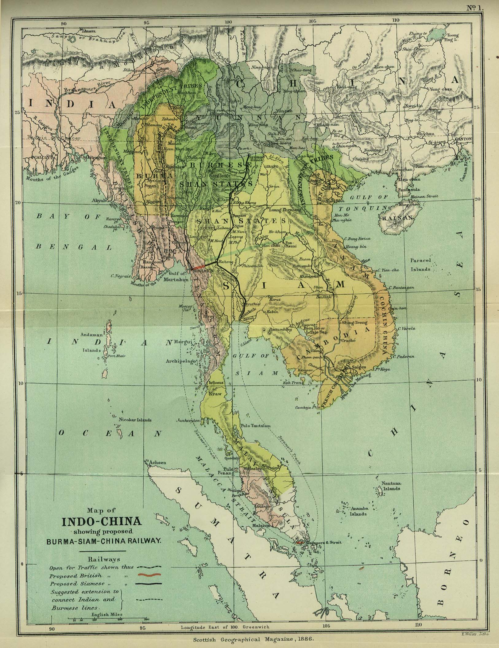
| Towritenness | Map of Indochina | ||||
| Tælmearc | |||||
| Fruma | http://www.lib.utexas.edu/maps/cambodia.html (http://www.lib.utexas.edu/maps/historical/indo_china_1886.jpg); Scottish Geographical Magazine (Volume II) | ||||
| Dædfruma | Scottish Geographical Magazine and edited by Hugh A. Webster and Arthur Silva White | ||||
| Leaf (Eftnytt þisse ymelan) |
|
||||
| Other versions | File:IndoChina1886.jpg | ||||
Ymelan stær
Swing dæg/tide mid mys to seonne þa ymelan swa heo wæs on þære tide geywed.
| Dæg/Tid | Metungincel | Micelnesse gemetu | Brucend | Ymbspræc | |
|---|---|---|---|---|---|
| nu | 02:56, 2 Þrimilcemonað 2008 | | 1,626 × 2,114 (533 KB) | Calliopejen1 | {{Information |Description=Map of French Indochina |Source=http://www.lib.utexas.edu/maps/cambodia.html (http://www.lib.utexas.edu/maps/historical/indo_china_1886.jpg) |Date=1886 |Author=Scottish Geographical Magazine |Permission={{PD-old}} |other_version |
Biliþbendas
Þǣr sind nāne trametas þe bindaþ tō þissum biliðe.
Ymelan eormen nytt
Þas wiki brucaþ þissa ymelena:
- Nytt on bcl.wikipedia.org
- Nytt on el.wikipedia.org
- Nytt on en.wikipedia.org
- Nytt on en.wikiversity.org
- Nytt on fi.wikipedia.org
- Nytt on got.wikipedia.org
- Nytt on kn.wikipedia.org
- Nytt on ms.wikipedia.org
- Nytt on pa.wikipedia.org
- Nytt on sl.wikipedia.org
- Nytt on uz.wikipedia.org