
Ymele:Boroughbridge town pump (geograph 6228554).jpg
Micelness þisre forebysene: 800 be 450 dotta. Oðra metinga brædo: 320 be 180 dotta | 640 be 360 dotta | 1,024 be 576 dotta | 1,280 be 720 dotta | 2,560 be 1,440 dotta.
Frumlicu ymele (2,560 × 1,440 pixela, ymelan micelness: 1.6 MB, MIME cynn: image/jpeg)
.jpg)
Scortness
| Towritenness |
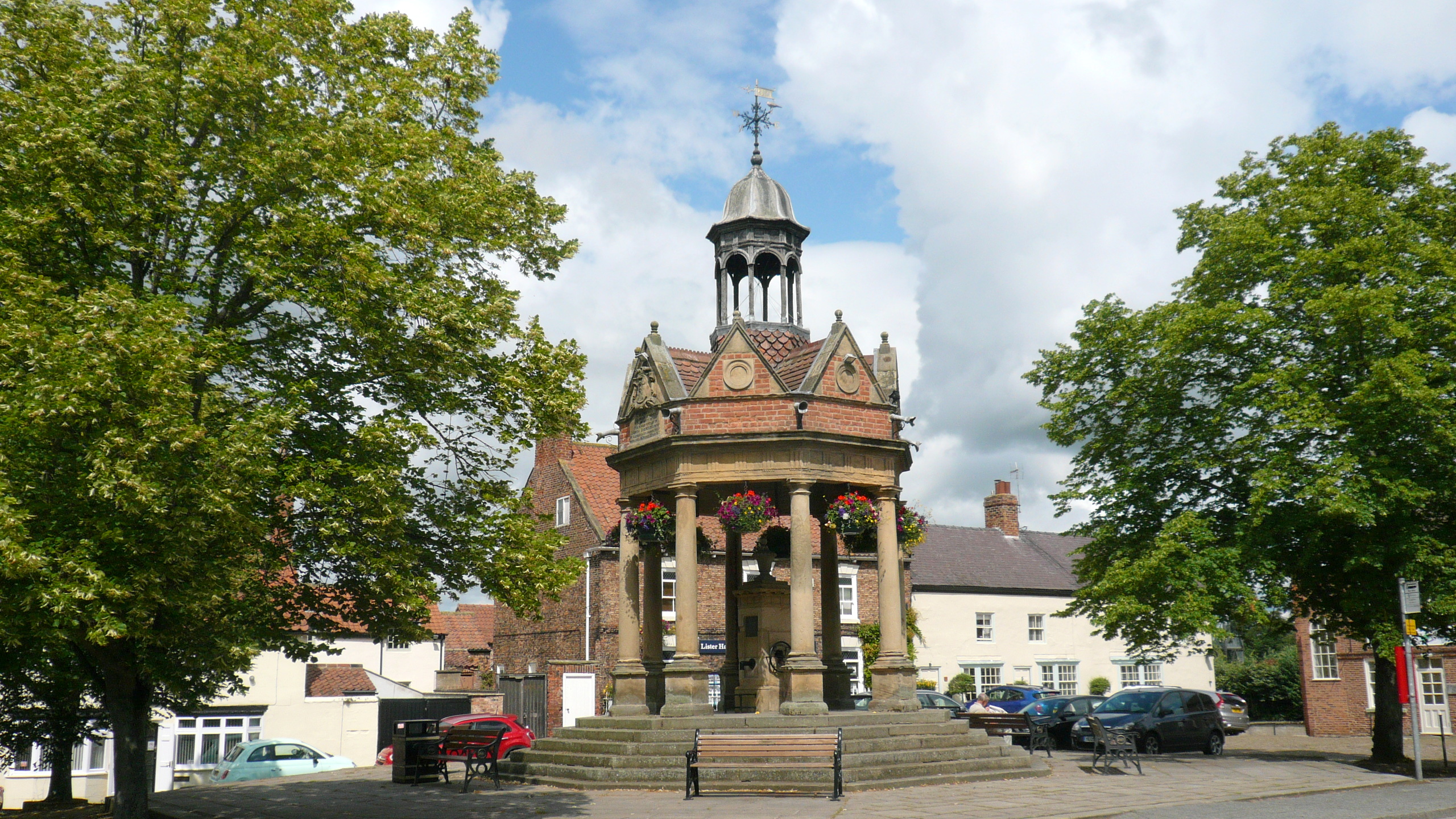
English: The cover over the 256-foot deep artesian well was built in 1875. It was gifted to the town by Mrs Lawson of Aldborough Manor in memory of her husband Andrew, who had died three years earlier. The extravagant canopy is one of the most ornate in England. |
| Tælmearc | |
| Fruma | From geograph.org.uk |
| Dædfruma | Mark Percy |
| Leaf (Eftnytt þisse ymelan) |
Creative Commons Attribution Share-alike license 2.0 |
| Hligung (required by the license) | Mark Percy / Boroughbridge town pump / |
| Camera location | | View this and other nearby images on: OpenStreetMap |
|---|
.jpg¶ms=054.093785_N_-001.396023_E_globe:Earth_type:camera_source:geograph-osgb36(SE396666)_heading:45.00&language=ang)
| Object location | | View this and other nearby images on: OpenStreetMap |
|---|
.jpg¶ms=054.093790_N_-001.396020_E_globe:Earth_class:object_type:object_source:geograph-osgb36(SE396666)_heading:45.00&language=ang)
Leaf:

|
This image was taken from the Geograph project collection. See this photograph's page on the Geograph website for the photographer's contact details. The copyright on this image is owned by Mark Percy and is licensed for reuse under the Creative Commons Attribution-ShareAlike 2.0 license.
|
This file is licensed under the Creative Commons Attribution-Share Alike 2.0 Generic license.
Hligung: Mark Percy
- Þu most:
- bryttian – to copy, distribute and transmit the work
- to remix – andwendan þæt weorc
- Under the following conditions:
- hlígung – You must give appropriate credit, provide a link to the license, and indicate if changes were made. You may do so in any reasonable manner, but not in any way that suggests the licensor endorses you or your use.
- Efenlice bryttiendlic – Gif þu andwende þis weorc to ohte, þu scleat bryttian þæt andwendede weorc synderlice mid þære ilcan oþþe gelicre leafe swilcre þis brycþ.
Ymelan stær
Swing dæg/tide mid mys to seonne þa ymelan swa heo wæs on þære tide geywed.
| Dæg/Tid | Metungincel | Micelnesse gemetu | Brucend | Ymbspræc | |
|---|---|---|---|---|---|
| nu | 20:36, 20 Hreðmonað 2023 | | 2,560 × 1,440 (1.6 MB) | Chocolateediter | == {{int:filedesc}} == {{Information |Description={{en|1= The cover over the 256-foot deep artesian well was built in 1875. It was gifted to the town by Mrs Lawson of Aldborough Manor in memory of her husband Andrew, who had died three years earlier. The extravagant canopy is one of the most ornate in England.}} |Source=From [https://www.geograph.org.uk/photo/6228554 geograph.org.uk] |Date=2019-07-11 |Author=[https://www.geograph.org.uk/profile/18030 Mark Percy] |Permission=Creative Commons A... |
Biliþbendas
Þā folgendan trametas bindaþ tō þissum biliðe:
Ymelan eormen nytt
Þas wiki brucaþ þissa ymelena:
- Nytt on en.wikipedia.org
.jpg)