
Ymele:Anglesey Brit Isles Sect 4.svg

Size of this PNG preview of this SVG file: 585 be 600 dotta. Oðra metinga brædo: 234 be 240 dotta | 468 be 480 dotta | 749 be 768 dotta | 999 be 1,024 dotta | 1,997 be 2,048 dotta | 627 be 643 dotta.
Frumlicu ymele (SVG ymele, rihte 627 × 643 pixela, ymelan micelness: 938 KB)
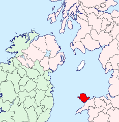
| Towritenness | Anglesey location map | ||
| Tælmearc | |||
| Fruma | British Isles in counties.svg | ||
| Dædfruma | User:Visitor from Wikishire | ||
| Leaf (Eftnytt þisse ymelan) |
|
Ymelan stær
Swing dæg/tide mid mys to seonne þa ymelan swa heo wæs on þære tide geywed.
| Dæg/Tid | Metungincel | Micelnesse gemetu | Brucend | Ymbspræc | |
|---|---|---|---|---|---|
| nu | 07:08, 14 Haligmonað 2019 | | 627 × 643 (938 KB) | Hogweard | Colours |
| 22:08, 11 Se Æfterra Gēola 2015 |  | 627 × 643 (933 KB) | Visitor from Wikishire | {{Information |Description=Anglesey location map |Source=British Isles in counties.svg |Date=2014-01-11 |Author=User:Visitor from Wikishire |Permission={{PD-self}} |other_versions= }} [[Category:Maps of histo... |
Biliþbendas
Þā folgendan trametas bindaþ tō þissum biliðe: