
Ymele:Lake taupo landsat.jpg
Micelness þisre forebysene: 800 be 593 dotta. Oðra metinga brædo: 320 be 237 dotta | 640 be 474 dotta | 1,024 be 758 dotta | 1,280 be 948 dotta.
Frumlicu ymele (1,280 × 948 pixela, ymelan micelness: 125 KB, MIME cynn: image/jpeg)
| Towritenness | ||||
| Tælmearc | 26 Hreðmonað 2005 (original upload date) | |||
| Fruma | Transferred from File:Lake taupo landsat.jpg (log) at English Wikipedia to Commons by Centic. The original uploader was John Fader at English Wikipedia. | |||
| Dædfruma | NASA | |||
| Leaf (Eftnytt þisse ymelan) |
|
|||
| Other versions | Derivative works of this file: Lake Taupo landsat -square crop.jpg |

| Camera location | | View this and other nearby images on: OpenStreetMap |
|---|
Ymelan stær
Swing dæg/tide mid mys to seonne þa ymelan swa heo wæs on þære tide geywed.
| Dæg/Tid | Metungincel | Micelnesse gemetu | Brucend | Ymbspræc | |
|---|---|---|---|---|---|
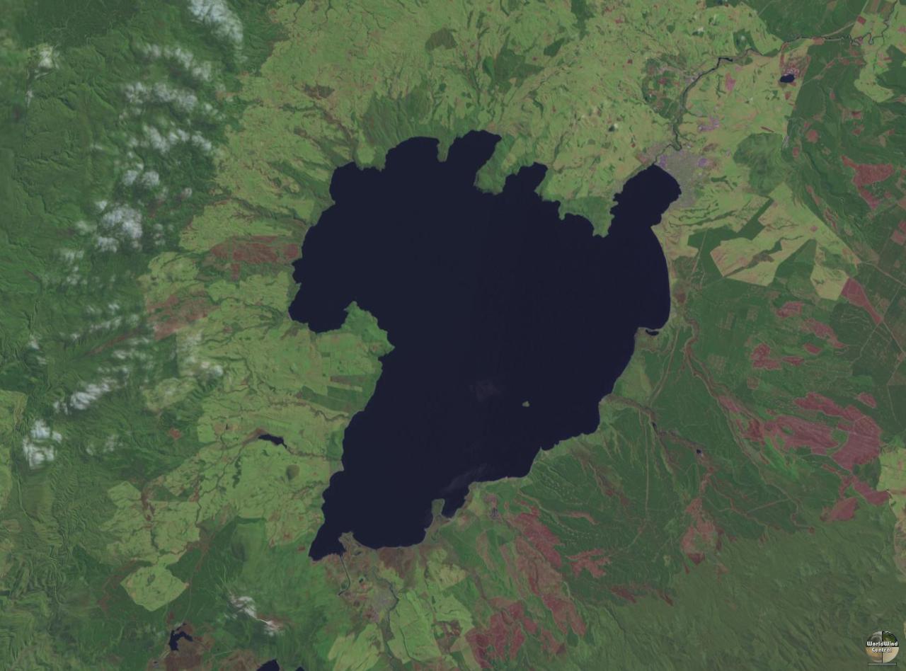
| nu | 13:08, 27 Mædmonað 2005 | | 1,280 × 948 (125 KB) | Centic | Lake Taupo showing some rock carvings from the 1970's. Photographed by Philo Vivero and placed into GFDL to help out Wikipedia. Moved from en-wiki, original edit-history: 08:46, 28 March 2004 . . PhiloVivero (56161 bytes) (Lake Taupo showing some rock c |
Biliþbendas
Þā folgendan trametas bindaþ tō þissum biliðe:
Ymelan eormen nytt
Þas wiki brucaþ þissa ymelena:
- Nytt on ar.wikipedia.org
- Nytt on az.wikipedia.org
- Nytt on bg.wikipedia.org
- Nytt on ca.wikipedia.org
- Nytt on cs.wikipedia.org
- Nytt on de.wikipedia.org
- Nytt on el.wikipedia.org
- Nytt on en.wikipedia.org
- Nytt on en.wikivoyage.org
- Nytt on eo.wikipedia.org
- Nytt on es.wikipedia.org
- Nytt on et.wikipedia.org
- Nytt on eu.wikipedia.org
- Nytt on fi.wikipedia.org
- Nytt on fr.wikipedia.org
- Nytt on fr.wikivoyage.org
- Nytt on ga.wikipedia.org
- Nytt on gl.wikipedia.org
- Nytt on he.wikipedia.org
- Nytt on hi.wikipedia.org
- Nytt on hu.wikipedia.org
View more global usage of this file.