
Ymele:VAMap-doton-Chesapeake.PNG
Nænig mare micelness nis brucendlicu.
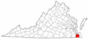
VAMap-doton-Chesapeake.PNG (300 × 134 pixela, ymelan micelness: 9 KB, MIME cynn: image/png)
Scortness
| Towritenness | Adapted from Wikipedia's VA county maps by Seth Ilys. |
| Tælmearc | 21 Þrimilcemonað 2005 (original upload date) |
| Fruma | Transferred from en.wikipedia to Commons. |
| Dædfruma | The original uploader was Seth Ilys at English Ƿikipǣdia. |
Leaf:
| This file is licensed under the Creative Commons Attribution-Share Alike 3.0 Unported license. Subject to disclaimers. | ||
| ||
| This licensing tag was added to this file as part of the GFDL licensing update. |

|
Permission is granted to copy, distribute and/or modify this document under the terms of the GNU Free Documentation License, Version 1.2 or any later version published by the Free Software Foundation; with no Invariant Sections, no Front-Cover Texts, and no Back-Cover Texts. A copy of the license is included in the section entitled GNU Free Documentation License. Subject to disclaimers. |
Original upload log
The original description page was here. All following user names refer to en.wikipedia.
- 2005-05-21 22:12 Seth Ilys 300×134×8 (8887 bytes) {{GFDL}}<br>Adapted from Wikipedia's VA county maps by [[User:Seth Ilys|Seth Ilys]].
Ymelan stær
Swing dæg/tide mid mys to seonne þa ymelan swa heo wæs on þære tide geywed.
| Dæg/Tid | Metungincel | Micelnesse gemetu | Brucend | Ymbspræc | |
|---|---|---|---|---|---|
| nu | 23:38, 10 Solmonaþ 2006 | | 300 × 134 (9 KB) | Michiel1972 | Locator maps U.S. cities derived from PD state maps by different users from en.wikipedia. <small>the filename has sometimes been adapted to the general syntax</small> {{GFDL}} category:Location maps of U.S. cities |
Biliþbendas
Þā folgendan trametas bindaþ tō þissum biliðe:
Ymelan eormen nytt
Þas wiki brucaþ þissa ymelena:
- Nytt on ar.wikipedia.org
- Nytt on ca.wikipedia.org
- Nytt on ceb.wikipedia.org
- Nytt on cy.wikipedia.org
- Nytt on de.wikipedia.org
- Nytt on el.wikipedia.org
- Nytt on en.wikipedia.org
- Chesapeake, Virginia
- South Norfolk, Virginia
- Bower's Hill, Virginia
- Great Bridge, Virginia
- Hickory, Virginia
- Western Branch, Virginia
- Deep Creek, Virginia
- Greenbrier, Virginia
- National Register of Historic Places listings in Chesapeake, Virginia
- User:LBourne/Scratch pad
- Template:Chesapeake, Virginia
- User:Nyttend/Virginia NRHP/City of Chesapeake
- Talk:List of cities and counties in Virginia/Archive 1
- Nytt on eo.wikipedia.org
- Nytt on eu.wikipedia.org
- Nytt on fa.wikipedia.org
- Nytt on fr.wikipedia.org
- Nytt on ga.wikipedia.org
- Nytt on gd.wikipedia.org
- Nytt on gl.wikipedia.org
- Nytt on ht.wikipedia.org
- Nytt on hu.wikipedia.org
- Nytt on id.wikipedia.org
- Nytt on it.wikipedia.org
- Nytt on ja.wikipedia.org
- Nytt on kn.wikipedia.org
- Nytt on pl.wikivoyage.org
- Nytt on pt.wikipedia.org
- Nytt on ro.wikipedia.org
- Nytt on ru.wikipedia.org
- Nytt on sh.wikipedia.org
- Nytt on simple.wikipedia.org
- Nytt on sr.wikipedia.org
- Nytt on tt.wikipedia.org
- Nytt on ur.wikipedia.org
- Nytt on vi.wikipedia.org
- Nytt on vo.wikipedia.org
- Nytt on www.wikidata.org
- Nytt on zh.wikipedia.org