
Ymele:Pitcairn Islands-CIA WFB Map.png
Nænig mare micelness nis brucendlicu.
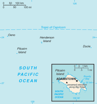
Pitcairn_Islands-CIA_WFB_Map.png (325 × 349 pixela, ymelan micelness: 6 KB, MIME cynn: image/png)
This image is in the public domain because it contains materials that originally came from the United States Central Intelligence Agency's World Factbook.
|
 |
derivative works
Derivative works of this file:
Ymelan stær
Swing dæg/tide mid mys to seonne þa ymelan swa heo wæs on þære tide geywed.
| Dæg/Tid | Metungincel | Micelnesse gemetu | Brucend | Ymbspræc | |
|---|---|---|---|---|---|
| nu | 05:16, 13 Solmonaþ 2022 | | 325 × 349 (6 KB) | Lojwe | Cropped 1 % horizontally, 1 % vertically using CropTool with precise mode. |
| 10:12, 21 Se Æfterra Gēola 2006 |  | 328 × 351 (6 KB) | Hoshie | Updated map from 10 Jan 06 rev. of the World Factbook: http://www.cia.gov/cia/publications/factbook/geos/pc.html | |
| 09:17, 27 Hreðmonað 2005 |  | 330 × 355 (3 KB) | Wolfman~commonswiki | {{CIA-map}} |
Biliþbendas
Þā folgendan trametas bindaþ tō þissum biliðe:
Ymelan eormen nytt
Þas wiki brucaþ þissa ymelena:
- Nytt on af.wikipedia.org
- Nytt on be-tarask.wikipedia.org
- Nytt on bg.wikipedia.org
- Nytt on en.wikipedia.org
- Nytt on en.wikisource.org
- Nytt on es.wikipedia.org
- Nytt on et.wikipedia.org
- Nytt on fi.wikipedia.org
- Nytt on frp.wikipedia.org
- Nytt on fr.wikipedia.org
- Nytt on fy.wikipedia.org
- Nytt on gl.wikipedia.org
- Nytt on hr.wikipedia.org
- Nytt on hu.wikipedia.org
- Nytt on id.wikipedia.org
- Nytt on it.wikipedia.org
- Nytt on ja.wikipedia.org
- Nytt on jv.wikipedia.org
- Nytt on la.wikipedia.org
- Nytt on lij.wikipedia.org
- Nytt on mk.wikipedia.org
- Nytt on mr.wikipedia.org
- Nytt on nl.wikipedia.org
- Nytt on nn.wikipedia.org
- Nytt on pih.wikipedia.org
- Nytt on pl.wikipedia.org
- Nytt on pl.wikivoyage.org
- Nytt on pt.wikipedia.org
- Nytt on ro.wikipedia.org
- Nytt on se.wikipedia.org
- Nytt on simple.wikipedia.org
- Nytt on sw.wikipedia.org
View more global usage of this file.