
Ymele:Nova Scotia-map.png
Nænig mare micelness nis brucendlicu.
Nova_Scotia-map.png (280 × 230 pixela, ymelan micelness: 14 KB, MIME cynn: image/png)

|
File:Nova Scotia, Canada.svg is a vector version of this file. It should be used in place of this PNG file when not inferior.
File:Nova Scotia-map.png → File:Nova Scotia, Canada.svg
For more information, see Help:SVG. |
 |
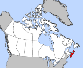
Map of Nova Scotia
Projection: Lambert azimuthal equal-area
Geospatial data from: The Atlas of Canada, The National Atlas of the United States and U.S. Geological Survey
Cartographer: John Fowler
| I, the copyright holder of this work, release this work into the public domain. This applies worldwide. In some countries this may not be legally possible; if so: I grant anyone the right to use this work for any purpose, without any conditions, unless such conditions are required by law. |
Ymelan stær
Swing dæg/tide mid mys to seonne þa ymelan swa heo wæs on þære tide geywed.
| Dæg/Tid | Metungincel | Micelnesse gemetu | Brucend | Ymbspræc | |
|---|---|---|---|---|---|
| nu | 12:16, 24 Hreðmonað 2005 | | 280 × 230 (14 KB) | Voyager | Map of Nova Scotia Projection: Lambert azimuthal equal-area Geospatial data from: [http://atlas.gc.ca/ The Atlas of Canada], [http://www.nationalatlas.gov/ The National Atlas of the United States] and [http://www.usgs.gov U.S. Geological Survey] Cartog |
Biliþbendas
Þǣr sind nāne trametas þe bindaþ tō þissum biliðe.
Ymelan eormen nytt
Þas wiki brucaþ þissa ymelena:
- Nytt on azb.wikipedia.org
- Nytt on bat-smg.wikipedia.org
- Nytt on br.wikipedia.org
- Nytt on en.wikipedia.org
- Nytt on en.wikinews.org
- Nytt on en.wiktionary.org
- Nytt on eo.wikipedia.org
- Nytt on frr.wikipedia.org
- Nytt on gd.wikipedia.org
- Nytt on hu.wiktionary.org
- Nytt on io.wikipedia.org
- Nytt on is.wikipedia.org
- Nytt on ja.wikipedia.org
- Nytt on kw.wikipedia.org
- Nytt on lij.wikipedia.org
- Nytt on mk.wikipedia.org
- Nytt on nn.wikipedia.org
- Nytt on pam.wikipedia.org
- Nytt on pms.wikipedia.org
- Nytt on ta.wikipedia.org
- Nytt on vo.wikipedia.org
- Nytt on xmf.wikipedia.org
- Nytt on zh-min-nan.wikipedia.org