
Ymele:LocationAntarctica.png

Micelness þisre forebysene: 800 be 407 dotta. Oðra metinga brædo: 320 be 163 dotta | 640 be 326 dotta | 1,024 be 521 dotta | 1,280 be 651 dotta | 2,759 be 1,404 dotta.
Frumlicu ymele (2,759 × 1,404 pixela, ymelan micelness: 50 KB, MIME cynn: image/png)

|
File:Antarctica Location.svg is a vector version of this file. It should be used in place of this PNG file when not inferior.
File:LocationAntarctica.png → File:Antarctica Location.svg
For more information, see Help:SVG. |
 |
Scortness
Español: Mapamundi mostrando la ubicación de la Antártida.
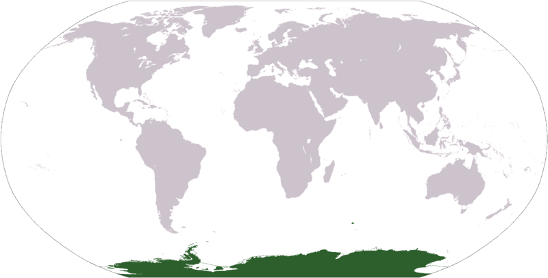
World map depicting Antarctica; map adapted from PDF world map at CIA World Fact Book.
Updated March 31, 2006 to remove green above 60°S line. in december there is 24 hours of sun light
Leaf:
This image is in the public domain because it contains materials that originally came from the United States Central Intelligence Agency's World Factbook.
|
 |
Ymelan stær
Swing dæg/tide mid mys to seonne þa ymelan swa heo wæs on þære tide geywed.
| Dæg/Tid | Metungincel | Micelnesse gemetu | Brucend | Ymbspræc | |
|---|---|---|---|---|---|
| nu | 17:13, 23 Eastermonað 2013 | | 2,759 × 1,404 (50 KB) | User02062000 | |
| 17:10, 23 Eastermonað 2013 |  | 2,759 × 1,404 (50 KB) | User02062000 | Reverted to version as of 18:54, 20 December 2005 | |
| 12:37, 19 Se Æfterra Gēola 2008 |  | 2,759 × 1,404 (97 KB) | F l a n k e r | Transparency | |
| 01:04, 31 Hreðmonað 2006 |  | 2,759 × 1,404 (55 KB) | David Kernow~commonswiki | ||
| 18:54, 20 Gēolmōnaþ 2005 |  | 2,759 × 1,404 (50 KB) | E Pluribus Anthony~commonswiki | World map: Antarctica (location) | |
| 12:38, 28 Eastermonað 2005 |  | 2,759 × 1,404 (39 KB) | Ghalas | Extracted from CIA World Factbook PDF world map, then rasterized and colored. {{PD-USGov-CIA-WF}} |
Biliþbendas
Þā folgendan trametas bindaþ tō þissum biliðe:
Ymelan eormen nytt
Þas wiki brucaþ þissa ymelena:
- Nytt on af.wikipedia.org
- Nytt on am.wikipedia.org
- Nytt on arc.wikipedia.org
- Nytt on ar.wikipedia.org
- Nytt on arz.wikipedia.org
- Nytt on ba.wikipedia.org
- Nytt on bcl.wikipedia.org
- Nytt on be-tarask.wikipedia.org
- Nytt on bjn.wikipedia.org
- Nytt on bn.wikipedia.org
- Nytt on bo.wikipedia.org
- Nytt on bpy.wikipedia.org
- Nytt on br.wikipedia.org
View more global usage of this file.