
Ymele:JanMayen.jpg
Nænig mare micelness nis brucendlicu.
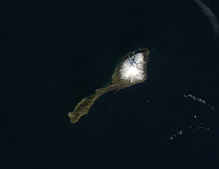
JanMayen.jpg (440 × 340 pixela, ymelan micelness: 5 KB, MIME cynn: image/jpeg)
Scortness
| Towritenness |
Deutsch: Satellitenfoto der Jan Mayen-Insel
English: Satellite picture of Jan Mayen Island, Greenland Sea
Español: Foto satélite de Jan Mayen
Suomi: Jan Mayen satelliittikuvassa
Čeština: Satelitní snímek ostrova Jan Mayen. Přibližné souřadnice: 70°58′59″ s. š., 8°30′00″ |
| Tælmearc | |
| Fruma | http://rapidfire.sci.gsfc.nasa.gov/gallery/?2004243-0830/JanMayen.A2004243.1225.250m.jpg |
| Dædfruma | Image courtesy of MODIS Rapid Response Project at NASA/GSFC |
| Leaf (Eftnytt þisse ymelan) |
http://lancedev.eosdis.nasa.gov/tools/rapid-response/about-imagery/ |
| Other versions | Image:JanMayen_angepasst.jpg |
Leaf:
| This file is in the public domain in the United States because it was solely created by NASA. NASA copyright policy states that "NASA material is not protected by copyright unless noted". (See Template:PD-USGov, NASA copyright policy page or JPL Image Use Policy.) | ||
 |
Warnings:
|
Ymelan stær
Swing dæg/tide mid mys to seonne þa ymelan swa heo wæs on þære tide geywed.
| Dæg/Tid | Metungincel | Micelnesse gemetu | Brucend | Ymbspræc | |
|---|---|---|---|---|---|
| nu | 19:23, 24 Gēolmōnaþ 2004 | | 440 × 340 (5 KB) | Veinsworld | Jan Mayen island |
Biliþbendas
Þā folgendan trametas bindaþ tō þissum biliðe:
Ymelan eormen nytt
Þas wiki brucaþ þissa ymelena:
- Nytt on bg.wikipedia.org
- Nytt on bn.wikipedia.org
- Nytt on bs.wikipedia.org
- Nytt on cs.wikipedia.org
- Nytt on de.wikipedia.org
- Nytt on el.wikipedia.org
- Nytt on en.wikipedia.org
- Nytt on eo.wikipedia.org
- Nytt on es.wikipedia.org
- Nytt on et.wikipedia.org
- Nytt on fa.wikipedia.org
- Nytt on fo.wikipedia.org
- Nytt on fr.wiktionary.org
- Nytt on gl.wikipedia.org
- Nytt on he.wikipedia.org
- Nytt on hr.wikipedia.org
- Nytt on ka.wikipedia.org
- Nytt on ko.wikipedia.org
- Nytt on ku.wikipedia.org
- Nytt on lv.wikipedia.org
- Nytt on nl.wikipedia.org
- Nytt on nn.wikipedia.org
- Nytt on pl.wikipedia.org
- Nytt on pl.wikivoyage.org
- Nytt on pl.wiktionary.org
- Nytt on pnb.wikipedia.org
- Nytt on su.wikipedia.org
- Nytt on ta.wikipedia.org
- Nytt on th.wikipedia.org
- Nytt on tr.wikipedia.org
- Nytt on uk.wikipedia.org
- Nytt on ur.wikipedia.org
- Nytt on vi.wikipedia.org
- Nytt on xal.wikipedia.org
- Nytt on yo.wikipedia.org
- Nytt on zh.wikipedia.org