
Ymele:Europe-Jersey.svg

Size of this PNG preview of this SVG file: 713 be 600 dotta. Oðra metinga brædo: 285 be 240 dotta | 571 be 480 dotta | 913 be 768 dotta | 1,218 be 1,024 dotta | 2,435 be 2,048 dotta | 2,045 be 1,720 dotta.
Frumlicu ymele (SVG ymele, rihte 2,045 × 1,720 pixela, ymelan micelness: 7.73 MB)
Scortness
| Towritenness |
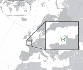
English: The Full Map of Jersey |
||
| Tælmearc | |||
| Fruma |
Own work based on: Europe-Northern Cyprus.svg and Europe-Serbia.svg |
||
| Dædfruma | Chipmunkdavis | ||
| Other versions |
Derivative works of this file: |
||
| SVG genesis |
|

Leaf:
This file is licensed under the Creative Commons Attribution-Share Alike 3.0 Unported license.
- Þu most:
- bryttian – to copy, distribute and transmit the work
- to remix – andwendan þæt weorc
- Under the following conditions:
- hlígung – You must give appropriate credit, provide a link to the license, and indicate if changes were made. You may do so in any reasonable manner, but not in any way that suggests the licensor endorses you or your use.
- Efenlice bryttiendlic – Gif þu andwende þis weorc to ohte, þu scleat bryttian þæt andwendede weorc synderlice mid þære ilcan oþþe gelicre leafe swilcre þis brycþ.
Original upload log
This image is a derivative work of the following images:
- Europe-Northern Cyprus.svg licensed with Cc-by-3.0
- 2011-02-20T17:16:12Z Chipmunkdavis 2045x1720 (2331880 Bytes) {{Information |Description={{en|1={{Europe-SVG-en|Northern Cyprus}}}} |Source=*[[:File:Europe-Serbia.svg|]] |Date=2011-02-20 17:14 (UTC) |Author=*[[:File:Europe-Serbia.svg|]]: {{click|image=TheEmirr-Logo.png|link=User:The Emi
- Jersey Map.svg licensed with PD-self
- 2009-04-02T01:46:41Z Ichwan Palongengi 626x433 (208689 Bytes) Remove the flaw...
- 2009-04-02T01:39:59Z Ichwan Palongengi 626x433 (207980 Bytes) {{Information |Description={{en|1=The Full Map of Jersey}} |Source=Own work by uploader |Author=[[User:Ichwan Palongengi|Ichwan Palongengi]] |Date=2009-03-01 |Permission= |other_versions= }} [[Category:Jersey]]
Uploaded with derivativeFX
Ymelan stær
Swing dæg/tide mid mys to seonne þa ymelan swa heo wæs on þære tide geywed.
| Dæg/Tid | Metungincel | Micelnesse gemetu | Brucend | Ymbspræc | |
|---|---|---|---|---|---|
| nu | 01:57, 8 Blotmonað 2017 | | 2,045 × 1,720 (7.73 MB) | Rob984 | Added circle like the original |
| 00:35, 8 Blotmonað 2017 |  | 2,045 × 1,720 (7.73 MB) | Rob984 | Modified to try to better locate the island both within the Channel and Europe (so multiple maps aren't needed) | |
| 07:49, 21 Solmonaþ 2011 |  | 2,045 × 1,720 (2.28 MB) | Chipmunkdavis | {{Information |Description={{en|1={{Europe-SVG-en|Northern Cyprus}}}} {{en|1=The Full Map of Jersey}} |Source=*File:Europe-Northern_Cyprus.svg *File:Jersey_Map.svg |Date=2011-02-21 07:48 (UTC) |Author=*File:Europe-Northern_Cyprus.svg: *[ |
Biliþbendas
Þā folgendan trametas bindaþ tō þissum biliðe:
Ymelan eormen nytt
Þas wiki brucaþ þissa ymelena:
- Nytt on af.wikipedia.org
- Nytt on ar.wikipedia.org
- Nytt on arz.wikipedia.org
- Nytt on ast.wikipedia.org
- Nytt on azb.wikipedia.org
- Nytt on az.wikipedia.org
- Nytt on be-tarask.wikipedia.org
- Nytt on be.wikipedia.org
- Nytt on bh.wikipedia.org
- Nytt on bn.wikipedia.org
- Nytt on ca.wikipedia.org
- Nytt on cdo.wikipedia.org
- Nytt on chr.wikipedia.org
- Nytt on cs.wikipedia.org
- Nytt on da.wikipedia.org
- Nytt on diq.wikipedia.org
- Nytt on en.wikipedia.org
- Nytt on en.wikivoyage.org
- Nytt on es.wikipedia.org
- Nytt on fa.wikipedia.org
- Nytt on fi.wikipedia.org
- Nytt on fr.wikipedia.org
- Nytt on ga.wikipedia.org
- Nytt on gl.wikipedia.org
- Nytt on hak.wikipedia.org
- Nytt on ha.wikipedia.org
- Nytt on he.wikipedia.org
- Nytt on he.wikivoyage.org
- Nytt on hr.wikipedia.org
- Nytt on hy.wikipedia.org
- Nytt on ia.wikipedia.org
- Nytt on incubator.wikimedia.org
- Nytt on is.wikipedia.org
- Nytt on it.wikipedia.org
View more global usage of this file.