
Ymele:China 100.78713E 35.63718N.jpg

Micelness þisre forebysene: 800 be 599 dotta. Oðra metinga brædo: 320 be 240 dotta | 640 be 479 dotta | 1,024 be 766 dotta | 1,280 be 958 dotta.
Frumlicu ymele (1,280 × 958 pixela, ymelan micelness: 226 KB, MIME cynn: image/jpeg)
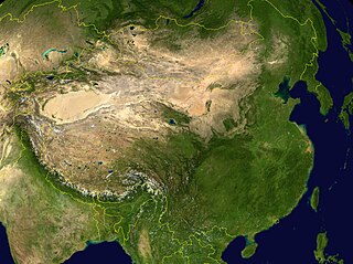
NASA World Wind screenshot.
| This image is in the public domain because it is a screenshot from NASA’s globe software World Wind using a public domain layer, such as Blue Marble, MODIS, Landsat, SRTM, USGS or GLOBE.
|
 |
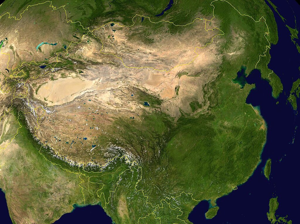
derivative works
Derivative works of this file: China 100.78713E 35.63718N-2010-23-08.jpg
.
Ymelan stær
Swing dæg/tide mid mys to seonne þa ymelan swa heo wæs on þære tide geywed.
| Dæg/Tid | Metungincel | Micelnesse gemetu | Brucend | Ymbspræc | |
|---|---|---|---|---|---|
| nu | 11:28, 15 Þrimilcemonað 2005 | | 1,280 × 958 (226 KB) | Rex | NASA World Wind screenshot. {{PD-USGov-NASA}} Category:Maps of China |
Biliþbendas
Þā folgendan trametas bindaþ tō þissum biliðe:
Ymelan eormen nytt
Þas wiki brucaþ þissa ymelena:
- Nytt on af.wikipedia.org
- Nytt on an.wikipedia.org
- Nytt on ar.wikipedia.org
- Nytt on az.wikipedia.org
- Nytt on bm.wikipedia.org
- Nytt on bn.wikipedia.org
- Nytt on bo.wikipedia.org
- Nytt on bxr.wikipedia.org
- Nytt on ca.wikipedia.org
- Nytt on ca.wikibooks.org
- Nytt on cs.wikipedia.org
- Nytt on da.wikipedia.org
- Nytt on dz.wikipedia.org
- Nytt on el.wikipedia.org
- Nytt on en.wikipedia.org
- Nytt on eo.wikipedia.org
- Nytt on es.wikipedia.org
- Nytt on fa.wikipedia.org
- Nytt on fo.wikipedia.org
- Nytt on fr.wikipedia.org
- Nytt on gcr.wikipedia.org
- Nytt on gl.wikipedia.org
- Nytt on hi.wikipedia.org
- Nytt on hr.wikipedia.org
- Nytt on hu.wikipedia.org
- Nytt on hy.wikipedia.org
- Nytt on hyw.wikipedia.org
- Nytt on id.wikipedia.org
- Nytt on ig.wikipedia.org
- Nytt on incubator.wikimedia.org
- Nytt on io.wikipedia.org
- Nytt on it.wikipedia.org
View more global usage of this file.