
Ymele:An aerial view of Narita International Airport.jpg

Micelness þisre forebysene: 800 be 531 dotta. Oðra metinga brædo: 320 be 213 dotta | 640 be 425 dotta | 1,024 be 680 dotta | 1,280 be 850 dotta | 2,560 be 1,700 dotta | 4,288 be 2,848 dotta.
Frumlicu ymele (4,288 × 2,848 pixela, ymelan micelness: 4.24 MB, MIME cynn: image/jpeg)
Scortness
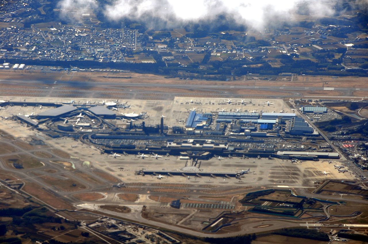
| Towritenness | An aerial view of Narita International Airport |
| Tælmearc | |
| Fruma | Narita Airport |
| Dædfruma | Marufish |
| Camera location | | View this and other nearby images on: OpenStreetMap |
|---|
Leaf:
This file is licensed under the Creative Commons Attribution-Share Alike 2.0 Generic license.
- Þu most:
- bryttian – to copy, distribute and transmit the work
- to remix – andwendan þæt weorc
- Under the following conditions:
- hlígung – You must give appropriate credit, provide a link to the license, and indicate if changes were made. You may do so in any reasonable manner, but not in any way that suggests the licensor endorses you or your use.
- Efenlice bryttiendlic – Gif þu andwende þis weorc to ohte, þu scleat bryttian þæt andwendede weorc synderlice mid þære ilcan oþþe gelicre leafe swilcre þis brycþ.
| This image was originally posted to Flickr by Marufish at https://www.flickr.com/photos/8819274@N04/3329007438. It was reviewed on 14 Weodmonað 2010 by FlickreviewR and was confirmed to be licensed under the terms of the cc-by-sa-2.0. |
Ymelan stær
Swing dæg/tide mid mys to seonne þa ymelan swa heo wæs on þære tide geywed.
| Dæg/Tid | Metungincel | Micelnesse gemetu | Brucend | Ymbspræc | |
|---|---|---|---|---|---|
| nu | 00:22, 14 Weodmonað 2010 | | 4,288 × 2,848 (4.24 MB) | Sp33dyphil | {{Information |Description=An aerial view of Narita International Airport |Source=[http://www.flickr.com/photos/marufish/3329007438/ Narita Airport] |Date=2009-02-17 13:39 |Author=[http://www.flickr.com/photos/8819274@N04 Marufish] |Permission= |other_ver |
Biliþbendas
Þā folgendan trametas bindaþ tō þissum biliðe:
Ymelan eormen nytt
Þas wiki brucaþ þissa ymelena:
- Nytt on ca.wikipedia.org
- Nytt on cs.wikipedia.org
- Nytt on de.wikipedia.org
- Nytt on en.wikipedia.org
- Nytt on en.wikivoyage.org
- Nytt on fr.wikivoyage.org
- Nytt on he.wikipedia.org
- Nytt on he.wikivoyage.org
- Nytt on incubator.wikimedia.org
- Nytt on it.wikipedia.org
- Nytt on it.wikivoyage.org
- Nytt on ja.wikipedia.org
- Nytt on ko.wikipedia.org
- Nytt on lfn.wikipedia.org
- Nytt on mn.wikipedia.org
- Nytt on pt.wikipedia.org
- Nytt on simple.wikipedia.org
- Nytt on uk.wikipedia.org
- Nytt on www.wikidata.org