
Ymele:South Orkney Islands-en.svg

Size of this PNG preview of this SVG file: 800 be 476 dotta. Oðra metinga brædo: 320 be 190 dotta | 640 be 381 dotta | 1,024 be 609 dotta | 1,280 be 761 dotta | 2,560 be 1,523 dotta | 2,303 be 1,370 dotta.
Frumlicu ymele (SVG ymele, rihte 2,303 × 1,370 pixela, ymelan micelness: 252 KB)
Scortness
| Towritenness |
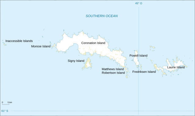
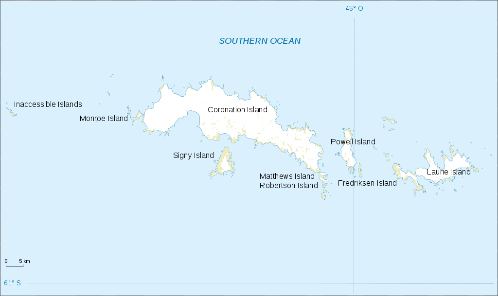
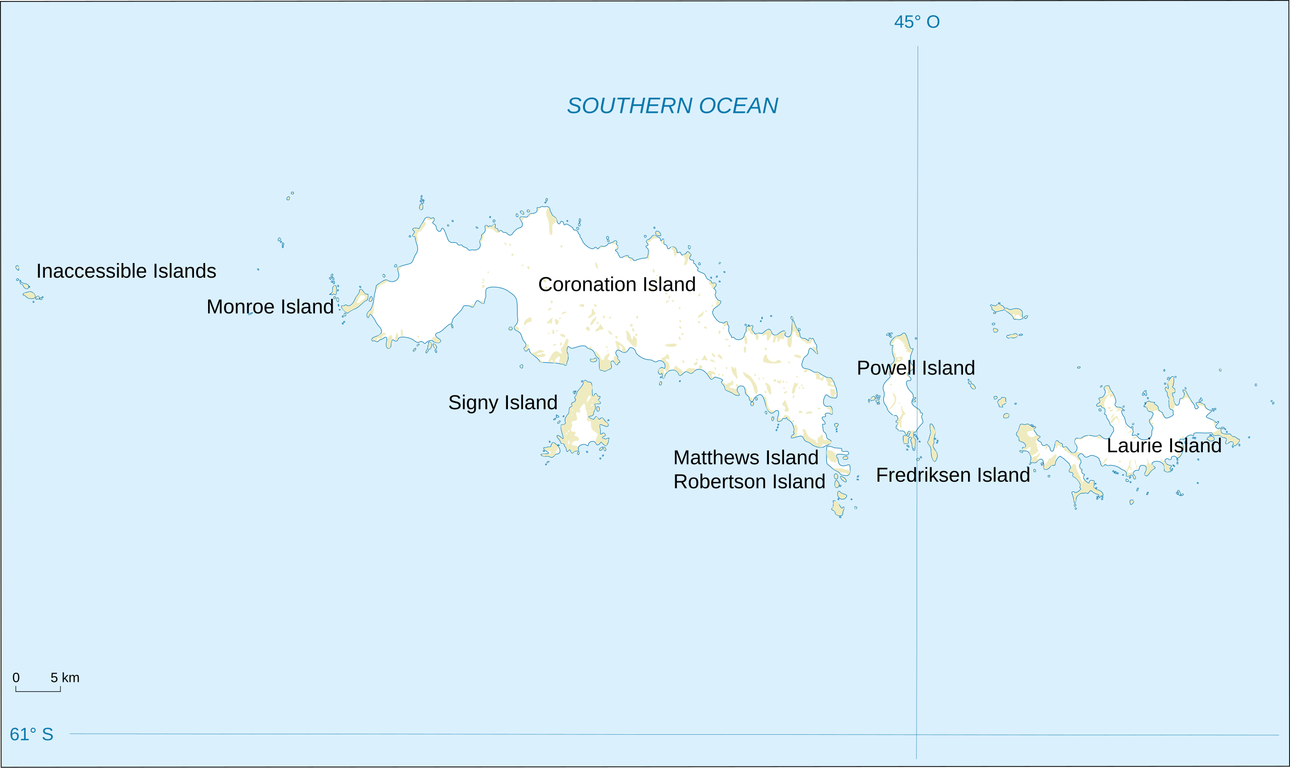
English: Map of South Orkney Islands.
Français : Carte des Iles Orcades du Sud.
Italiano: Mappa delle Isole Orcadi Meridionali. |
| Tælmearc | |
| Fruma | Landsat Image Mosaic Of Antarctica (LIMA) |
| Dædfruma | Shakki |
| Other versions |
|


Leaf:
This image is in the public domain in the United States because it only contains materials that originally came from the United States Geological Survey, an agency of the United States Department of the Interior. For more information, see the official USGS copyright policy.
|
Ymelan stær
Swing dæg/tide mid mys to seonne þa ymelan swa heo wæs on þære tide geywed.
| Dæg/Tid | Metungincel | Micelnesse gemetu | Brucend | Ymbspræc | |
|---|---|---|---|---|---|
| nu | 18:32, 17 Hreðmonað 2008 | | 2,303 × 1,370 (252 KB) | Shakki | {{Information |Description={{en|Map of South Orkney Islands}} {{fr|Carte des Iles Orcades du Sud}} |Source=[http://gisdata.usgs.gov/website/antarctic_research_atlas/ Landsat Image Mosaic Of Antarctica (LIMA)] |Date=Mar 2008 |Author=Shakki |
Biliþbendas
Þā folgendan trametas bindaþ tō þissum biliðe:
Ymelan eormen nytt
Þas wiki brucaþ þissa ymelena:
- Nytt on af.wikipedia.org
- Nytt on ar.wikipedia.org
- Nytt on ast.wikipedia.org
- Nytt on az.wikipedia.org
- Nytt on be.wikipedia.org
- Nytt on br.wikipedia.org
- Nytt on bs.wikipedia.org
- Nytt on ca.wikipedia.org
- Nytt on ceb.wikipedia.org
- Nytt on cs.wikipedia.org
- Nytt on da.wikipedia.org
- Nytt on de.wikipedia.org
- Nytt on el.wikipedia.org
- Nytt on en.wikipedia.org
- South Orkney Islands
- Scottish National Antarctic Expedition
- Laws Glacier
- Buchanan Point
- Orwell Glacier
- Jane Peak
- Sunshine Glacier
- Cape Murdoch
- Cape Mabel
- McLeod Glacier (South Orkney Islands)
- Thomson Point
- Cape Valavielle
- Cape Robertson
- Roald Glacier
- Tioga Lake (South Orkney Islands)
- Three Lakes Valley (South Orkney Islands)
- Module:Location map/data/South Orkney Islands
- Module:Location map/data/South Orkney Islands/doc
- Nytt on es.wikipedia.org
- Nytt on fa.wikipedia.org
View more global usage of this file.