
Ymele:Norway Counties Sogn og Fjordane Position.svg

Size of this PNG preview of this SVG file: 562 be 600 dotta. Oðra metinga brædo: 225 be 240 dotta | 450 be 480 dotta | 719 be 768 dotta | 959 be 1,024 dotta | 1,918 be 2,048 dotta | 740 be 790 dotta.
Frumlicu ymele (SVG ymele, rihte 740 × 790 pixela, ymelan micelness: 67 KB)
| Towritenness |
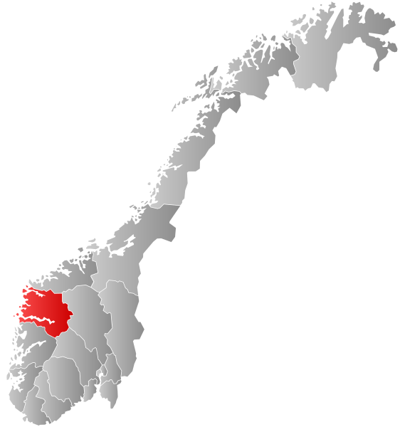
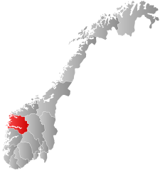
Autogenerated locator map of Norwegian county as named in filename. Exact copy needed at new filename for use in which automatically inserts maps and requires filename to match fylke name. |
| Tælmearc | (UTC) |
| Fruma | |
| Dædfruma |
|
| This is a retouched picture, which means that it has been digitally altered from its original version. The original can be viewed here: Norway Counties SognogFjordane Position.svg:
|
I, the copyright holder of this work, hereby publish it under the following license:
This file is licensed under the Creative Commons Attribution-Share Alike 2.5 Generic license.
- Þu most:
- bryttian – to copy, distribute and transmit the work
- to remix – andwendan þæt weorc
- Under the following conditions:
- hlígung – You must give appropriate credit, provide a link to the license, and indicate if changes were made. You may do so in any reasonable manner, but not in any way that suggests the licensor endorses you or your use.
- Efenlice bryttiendlic – Gif þu andwende þis weorc to ohte, þu scleat bryttian þæt andwendede weorc synderlice mid þære ilcan oþþe gelicre leafe swilcre þis brycþ.
Original upload log
This image is a derivative work of the following images:
- File:Norway_Counties_SognogFjordane_Position.svg licensed with Cc-by-sa-2.5
- 2007-09-21T21:28:39Z Marmelad 256x256 (84333 Bytes) {{Information |Description=Autogenerated locator map of norwegian county as named in filename. |Source=Based on [[:Image:Norway counties blank.svg]] |Date=2007-09-21 |Author=[[User:marmelad|Marmelad]] |Permission=Own work, sh
Uploaded with derivativeFX
Ymelan stær
Swing dæg/tide mid mys to seonne þa ymelan swa heo wæs on þære tide geywed.
| Dæg/Tid | Metungincel | Micelnesse gemetu | Brucend | Ymbspræc | |
|---|---|---|---|---|---|
| nu | 08:25, 27 Se Æfterra Gēola 2019 | | 740 × 790 (67 KB) | Bjarkan | Border update (Rindal). |
| 03:06, 17 Gēolmōnaþ 2017 |  | 740 × 790 (67 KB) | Bjarkan | Improved version. | |
| 11:45, 24 Se Æfterra Gēola 2016 |  | 740 × 790 (81 KB) | Fleinn | Reverted to version as of 13:11, 16 August 2010 (UTC) | |
| 02:03, 19 Se Æfterra Gēola 2016 |  | 512 × 512 (82 KB) | Kingsocarso | Reverted to version as of 03:46, 6 April 2009 (UTC) | |
| 13:11, 16 Weodmonað 2010 |  | 740 × 790 (81 KB) | Fleinn | Added gradient. | |
| 03:46, 6 Eastermonað 2009 |  | 512 × 512 (82 KB) | AjaxSmack | {{Information |Description=Autogenerated locator map of Norwegian county as named in filename. Exact copy needed at new filename for use in en:Template:Infobox Fylke which automatically inserts maps and requires filename to match ''fylke'' name. |Sour |
Biliþbendas
Þā folgendan trametas bindaþ tō þissum biliðe:
Ymelan eormen nytt
Þas wiki brucaþ þissa ymelena:
- Nytt on af.wikipedia.org
- Nytt on ar.wikipedia.org
- Nytt on ast.wikipedia.org
- Nytt on azb.wikipedia.org
- Nytt on be.wikipedia.org
- Nytt on bg.wikipedia.org
- Nytt on bpy.wikipedia.org
- Nytt on br.wikipedia.org
- Nytt on bs.wikipedia.org
- Nytt on ca.wikipedia.org
- Nytt on da.wikipedia.org
- Nytt on en.wikipedia.org
- Sogn og Fjordane
- Flora, Norway
- Balestrand
- Leikanger
- Gaular
- Jølster
- Førde
- Naustdal
- Vågsøy
- Selje
- Hornindal
- Florø
- Eid, Norway
- Borgund, Sogn og Fjordane
- Davik
- Hafslo
- Breim
- Kyrkjebø
- Sør-Vågsøy
- Nord-Vågsøy
- Jostedal
- Bru, Sogn og Fjordane
- Kinn (former municipality)
- Brekke
- Lavik
- Lavik og Brekke
- Vevring
- Eikefjord
- Innvik
- Sogn og Fjordane County Municipality
- Nordic Mining
- Nytt on eo.wikipedia.org
- Nytt on eu.wikipedia.org
- Nytt on fa.wikipedia.org
View more global usage of this file.