
Ymele:Map Norway political-geo.png

Frumlicu ymele (1,920 × 2,902 pixela, ymelan micelness: 924 KB, MIME cynn: image/png)
Scortness
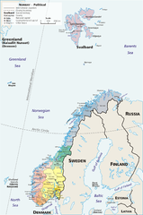
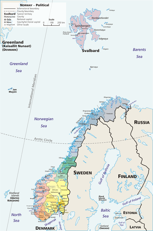
Map: Norway – geopolitical
Exhibits counties (fylker) of Norway (19); colours correspond to regions of Norway:
- yellow: Østlandet (Austlandet)
- orange: Sørlandet
- red: Vestlandet
- green: Trøndelag
- blue: Nord-Norge
Also:
Drawn by E Pluribus Anthony, adapted from:
- Statistics Norway: This is Norway Yearbook, p. 44 (PDF)
- National Geographic Xpeditions Atlas (Map Machine): Norway (PDF)
- Image:Bjornoya map.png

|
This map image could be re-created using vector graphics as an SVG file. This has several advantages; see Commons:Media for cleanup for more information. If an SVG form of this image is available, please upload it and afterwards replace this template with
{{vector version available|new image name}}.
It is recommended to name the SVG file “Map Norway political-geo.svg”—then the template Vector version available (or Vva) does not need the new image name parameter. |
Leaf:
| This work has been released into the public domain by its author, E Pluribus Anthony. This applies worldwide. In some countries this may not be legally possible; if so: |
Link: http://en.wikipedia.org/wiki/Image:Map_Norway_political-geo.png
derivative works
Derivative works of this file: Jan Mayen ringed.png
Ymelan stær
Swing dæg/tide mid mys to seonne þa ymelan swa heo wæs on þære tide geywed.
| Dæg/Tid | Metungincel | Micelnesse gemetu | Brucend | Ymbspræc | |
|---|---|---|---|---|---|
| nu | 06:36, 30 Mædmonað 2010 | | 1,920 × 2,902 (924 KB) | Hayden120 | Restored map proportions to original. |
| 06:26, 30 Mædmonað 2010 |  | 1,920 × 2,902 (1.04 MB) | Hayden120 | Corrected spelling of Trøndelag. | |
| 14:25, 1 Þrimilcemonað 2006 |  | 1,920 × 2,902 (969 KB) | Mortadelo2005 | == Summary == Map: Norway – geopolitical Exhibits counties (''fylker'') of Norway (19); colours correspond to regions of Norway: * yellow: Østlandet (Austlandet) * orange: Sørlandet * red: Vestlandet * g |
Biliþbendas
Þā folgendan trametas bindaþ tō þissum biliðe:
Ymelan eormen nytt
Þas wiki brucaþ þissa ymelena:
- Nytt on af.wikipedia.org
- Nytt on ar.wikipedia.org
- Nytt on ast.wikipedia.org
- Nytt on awa.wikipedia.org
- Nytt on azb.wikipedia.org
- Nytt on az.wikipedia.org
- Nytt on ban.wikipedia.org
- Nytt on be.wikipedia.org
- Nytt on bpy.wikipedia.org
- Nytt on bug.wikipedia.org
- Nytt on ca.wikipedia.org
- Nytt on crh.wikipedia.org
- Nytt on cy.wikipedia.org
- Nytt on da.wikipedia.org
- Nytt on de.wikipedia.org
- Nytt on diq.wikipedia.org
- Nytt on dsb.wikipedia.org
- Nytt on dty.wikipedia.org
- Nytt on el.wikipedia.org
- Nytt on en.wikipedia.org
- Nytt on es.wikipedia.org
- Nytt on es.wikibooks.org
- Nytt on fa.wikipedia.org
- Nytt on fj.wikipedia.org
- Nytt on fo.wikipedia.org
- Nytt on fr.wikipedia.org
View more global usage of this file.