
Ymele:LocationSouthAfrica.png
Nænig mare micelness nis brucendlicu.
LocationSouthAfrica.png (250 × 115 pixela, ymelan micelness: 5 KB, MIME cynn: image/png)
Afrikaans: 'n Geografiese kaart om die posisie van Suid-Afrika aan te dui.
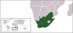
English: Location map for South Africa.
Čeština: Poloha Jihoafrické republiky.
Originally created for English Wikipedia by Vardion.
| |
This work has been released into the public domain by its author, Vardion, at the [[::|English Ƿikipǣdia]] project. This applies worldwide. In case this is not legally possible: |

|
File:LocationSouthAfrica.svg is a vector version of this file. It should be used in place of this PNG file when not inferior.
File:LocationSouthAfrica.png → File:LocationSouthAfrica.svg
For more information, see Help:SVG. |
 |
Ymelan stær
Swing dæg/tide mid mys to seonne þa ymelan swa heo wæs on þære tide geywed.
| Dæg/Tid | Metungincel | Micelnesse gemetu | Brucend | Ymbspræc | |
|---|---|---|---|---|---|
| nu | 03:23, 13 Gēolmōnaþ 2004 | | 250 × 115 (5 KB) | EugeneZelenko | Location map for the South Africa.<br/>Originally created for English Wikipedia by Vardion.<br/>{{PD}}<br/>Category:Country locator maps |
Biliþbendas
Þǣr sind nāne trametas þe bindaþ tō þissum biliðe.
Ymelan eormen nytt
Þas wiki brucaþ þissa ymelena:
- Nytt on ar.wikinews.org
- قالب:جنوب أفريقيا
- جنوب أفريقيا تفرض ملصقات لتمييز بضائع الأراضي المحتلة عن المصنوعة في إسرائيل
- قيادة الشرطة في بيترماريتزبرغ توقف اختبارات القبول بعد وفاة سبعة مرشحين
- رئيس جنوب إفريقيا يدعو مواطنيه للامتناع عن زيارة "إسرائيل"
- حماس تشيد بدعوة رئيس جنوب إفريقيا عدم زيارة "إسرائيل"
- اعتماد المجلس الوطني الفلسطيني عضواً مراقباً في البرلمان الإفريقي
- جنوب إفريقيا تعلن مقاطعتها القمة الإفريقية-"الإسرائيلية"
- حفيد مانديلا: فلسطين تعاني من أسوأ أنواع الأبارتهايد
- أغنية كأس أمم أفريقيا تحتفي بالسلام
- Nytt on bpy.wikipedia.org
- Nytt on br.wikipedia.org
- Nytt on br.wiktionary.org
- Nytt on ca.wikipedia.org
- Nytt on ceb.wikipedia.org
- Nytt on de.wikipedia.org
- Bontebok-Nationalpark
- Addo-Elefanten-Nationalpark
- Mountain-Zebra-Nationalpark
- West-Coast-Nationalpark
- ISimangaliso-Wetland-Park
- Augrabiesfälle
- Tsitsikamma-Nationalpark
- Goegap Nature Reserve
- Namaqua-Nationalpark
- Anysberg Nature Reserve
- Tankwa-Karoo-Nationalpark
- De Mond Nature Reserve
- Oorlogskloof Nature Reserve
- Grootvadersbosch Nature Reserve
- Rocherpan Nature Reserve
- Golden-Gate-Highlands-Nationalpark
- Akkerendam Nature Reserve
- Marloth Nature Reserve
- De Hoop Nature Reserve
- Gamkaberg Nature Reserve
- Bird Island Nature Reserve
- Midmar Nature Reserve
- Hluhluwe-iMfolozi-Park
- Karoo-Nationalpark
- Knysna National Lake Area
- Mapungubwe-Nationalpark
- Marakele-Nationalpark
- Tafelberg-Nationalpark
- Wilderness-Nationalpark
- Agulhas-Nationalpark
- Caledon Nature Reserve (Freistaat)
- Mokala-Nationalpark
- Camdeboo-Nationalpark
- Garden-Route-Nationalpark
- Tembe Elephant Park
View more global usage of this file.