
Ymele:Korea topographic map.png
Micelness þisre forebysene: 390 be 599 dotta. Oðra metinga brædo: 156 be 240 dotta | 312 be 480 dotta | 896 be 1,376 dotta.
Frumlicu ymele (896 × 1,376 pixela, ymelan micelness: 1.18 MB, MIME cynn: image/png)
| Towritenness |
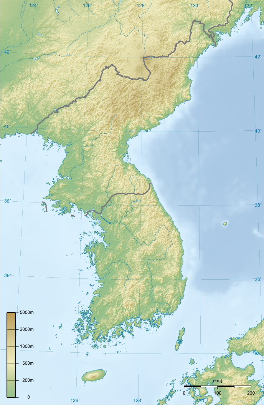
English: Topographic map of Korea.
한국어: 한국의 지형도. |
||||||||||
| Tælmearc | |||||||||||
| Fruma | Agen weorc | ||||||||||
| Dædfruma | Ksiom | ||||||||||
| Leaf (Eftnytt þisse ymelan) |
|
||||||||||
| Other versions | Derivative works of this file: North Korea topographic map.png |

Ymelan stær
Swing dæg/tide mid mys to seonne þa ymelan swa heo wæs on þære tide geywed.
| Dæg/Tid | Metungincel | Micelnesse gemetu | Brucend | Ymbspræc | |
|---|---|---|---|---|---|
| nu | 18:00, 27 Solmonaþ 2009 | | 896 × 1,376 (1.18 MB) | Ksiom | Reverted to version as of 23:21, 21 February 2009. Unimpaired scale bar |
| 15:08, 22 Solmonaþ 2009 |  | 802 × 1,376 (1.11 MB) | Valentim | Reverted to version as of 10:45, 31 January 2009. Focused view better. | |
| 23:21, 21 Solmonaþ 2009 |  | 896 × 1,376 (1.18 MB) | Ksiom | Reverted to version as of 22:04, 13 November 2008 | |
| 10:45, 31 Se Æfterra Gēola 2009 |  | 802 × 1,376 (1.11 MB) | Valentim | View centered on North and South Korea | |
| 22:04, 13 Blotmonað 2008 |  | 896 × 1,376 (1.18 MB) | Ksiom | ||
| 23:11, 16 Weodmonað 2008 |  | 899 × 1,379 (1.3 MB) | Ksiom | ||
| 19:33, 15 Weodmonað 2008 |  | 1,039 × 1,494 (1.36 MB) | Ksiom | ||
| 18:34, 15 Weodmonað 2008 |  | 1,040 × 1,494 (1.36 MB) | Ksiom | UTM Projection | |
| 00:52, 9 Weodmonað 2008 |  | 1,000 × 1,450 (1.33 MB) | Ksiom | {{Information |Description={{en|1=Topographic map of Korea.}} {{ko|1=한국의 지형도.}} |Source=Own work by uploader |Author=Ksiom |Date=2008-08-09 |Permission={{GFDL-GMT}} |other_versions= }} {{ImageUpload|full}} [[Category:Maps of Ko |
Biliþbendas
Þā folgendan trametas bindaþ tō þissum biliðe:
Ymelan eormen nytt
Þas wiki brucaþ þissa ymelena:
- Nytt on br.wikipedia.org
- Nytt on da.wikipedia.org
- Nytt on da.wikibooks.org
- Nytt on en.wikipedia.org
- Nytt on fr.wikipedia.org
- Nytt on fr.wiktionary.org
- Nytt on mt.wikipedia.org