
Ymele:Brazil State Amazonas.svg

Frumlicu ymele (SVG ymele, rihte 702 × 687 pixela, ymelan micelness: 676 KB)

|
Standardization of derivative maps
Feel free to create derivations of this work, but if you want to illustrate a Wikipedia article with derivative works of this or similar maps of Brazil, please strictly follow the visual standard, nomenclature and classification already in use. All maps of Brazilian subdivisions are being adaptated or created in this way. We do not want to inhibit creativity but the pattern adopted here was presented and accepted by the Lusophone community and should be followed whenever possible. |
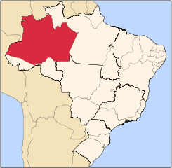
| Towritenness | Map locator of Brazil's Amazonas state | ||||||||
| Tælmearc | |||||||||
| Fruma | Agen weorc | ||||||||
| Dædfruma | Raphael Lorenzeto de Abreu | ||||||||
| Leaf (Eftnytt þisse ymelan) |
I, the copyright holder of this work, hereby publish it under the following licenses:
This file is licensed under the Creative Commons Attribution 2.5 Generic license.
Þu most ceosan leafe |
||||||||
| Other versions | Derivative works of this file: Distribution of Schlumbergera.png |

Ymelan stær
Swing dæg/tide mid mys to seonne þa ymelan swa heo wæs on þære tide geywed.
| Dæg/Tid | Metungincel | Micelnesse gemetu | Brucend | Ymbspræc | |
|---|---|---|---|---|---|
| nu | 03:07, 3 Sēremōnaþ 2006 | | 702 × 687 (676 KB) | Raphael.lorenzeto | |
| 02:51, 3 Sēremōnaþ 2006 |  | 702 × 687 (676 KB) | Raphael.lorenzeto | ||
| 09:30, 25 Eastermonað 2006 |  | 702 × 687 (448 KB) | Raphael.lorenzeto | {{Information| |Description=Map locator of Brazil's Amazonas state |Source=own work |Date=April, 23 2006 |Author=Raphael Lorenzeto de Abreu |Permission={{self2|GFDL|cc-by-2.5}} |other_versions= }} Category:Maps of Amazonas Category:Maps of Brazil |
Biliþbendas
Þā folgendan trametas bindaþ tō þissum biliðe:
Ymelan eormen nytt
Þas wiki brucaþ þissa ymelena:
- Nytt on af.wikipedia.org
- Nytt on be-tarask.wikipedia.org
- Nytt on be.wikipedia.org
- Nytt on bg.wikipedia.org
- Nytt on bpy.wikipedia.org
- Nytt on bs.wikipedia.org
- Nytt on da.wikipedia.org
- Nytt on de.wikipedia.org
- Nytt on en.wikipedia.org
- Amazonas (Brazilian state)
- Manaus
- Tabatinga
- Tefé
- Parintins
- São Gabriel da Cachoeira
- Manacapuru
- Coari
- Lábrea
- List of municipalities in Amazonas
- Santo Antônio do Içá
- São Paulo de Olivença
- Alvarães, Amazonas
- Amaturá
- Anamã
- Anori
- Apuí
- Atalaia do Norte
- Autazes
- Barcelos, Amazonas
- Barreirinha
- Benjamin Constant, Amazonas
- Beruri
- Boa Vista do Ramos
- Boca do Acre
- Borba, Amazonas
- Caapiranga
- Canutama
- Carauari
- Careiro
View more global usage of this file.